Overview
- Distance: 20 miles; 32 km
- Time: 10 hours (to complete the challenge)
- Total Ascent: 1399 m; 4590 ft
- GPX File: Download (desktop only) – What is a GPX file?
- Map: The Peak District OL1
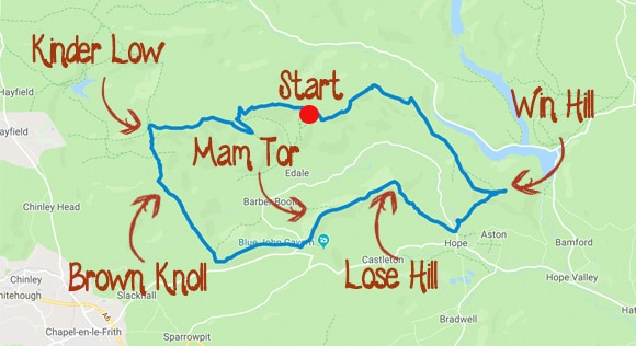
- Route: View route in Google Maps
Order and Height of Peaks
- Win Hill Height: 462 m; 1515 ft
- Lose Hill Height: 476 m; 1561 ft
- Hollins Cross Height: 392m; 1286 ft
- Mam Tor Height: 517 m; 1696 ft
- Brown Knoll Height: 569m; 1866 ft
- Kinder Scout Low Height: 633 m; 2076 ft
- Grindslow Knoll Height: 601 m; 1972ft
Key points along the route
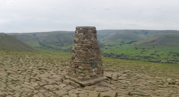
Win Hill, Lose Hill, Mam Tor, Brown Knoll and Kinder Scout Low have trigs identifying their highest point.
Edale Skyline Challenge
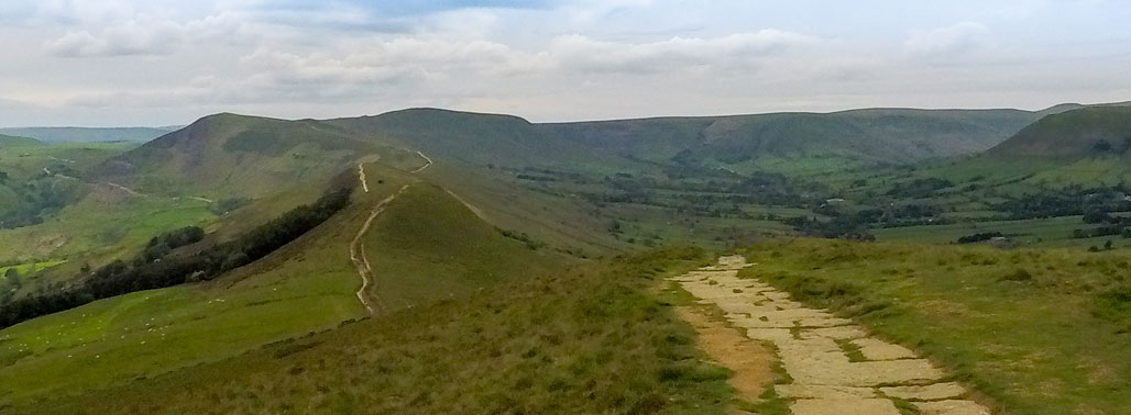
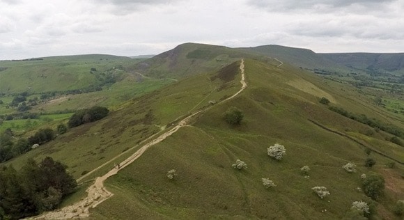
The Edale Skyline is a loop walk starting and returning to the same place along the ridge of Edale. It’s a great walk with amazing views. You walk the skyline of Edale and Hope Valley, with inclines and declines, challenging your legs along the way. The route has variety: the views of Ladybower Reservoir, Edale Rocks, Mam Tor and the ridge walk, Noe Stool and Kinder Scout Low.
The Edale Skyline is a classic walk in the Peak District and is popular among fell runners and hikers. It is a perfect training walk for the Yorkshire Three Peaks or the National Three Peaks.
This guide starts in Edale to accommodate those coming by public transport. Edale has a train station and car park making it accessible for all. You can start your challenge anywhere on the Edale Skyline and this guide will be updated shortly with other starting points.
The downloadable route starts from Edale train station/car park.
Parking and Transport
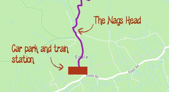
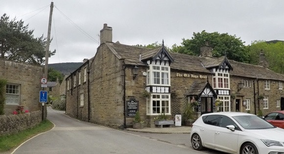
Edale train station and car park are close to each other. They are both a short walk to The Nags Head, where the walk to the Edale Skyline Challenge begins. Start timing your challenge once you reach the top of Ringing Roger.
The Edale Village Hall Car Park is a pay-and-display car park. The full address is Edale Village Hall Car Park, Edale, Hope Valley, S33 7ZQ.
A full day’s parking is £6.30. The car park is cash only. Paying by card or phone is not an option at the moment. The car park does get busy, but has space for 140 cars. The car park is checked regularly by wardens and an overflow car park is available on peak days.
The car park has limited disabled and coach parking.
Accommodation
If you are staying in Edale before or after your Edale Skyline Challenge, you can view a list of campsites, B&Bs, lodges, inns and bunk barns.
Timings and Checkpoints
The Edale Skyline Challenge is to complete the route in under 10 hours. Not everyone is concerned about their finish time, though, and completing the Edale Skyline is a fun challenge, even without time constraints.
Use the below checkpoints to help estimate your finish time of the Edale Skyline Challenge.
| Checkpoint | Time |
|---|---|
| Win Hill | 2 hours 50 mins |
| Mam Tor | 5 hours 20 mins |
| Kinder Low | 8 hours |
| Ringing Roger | 10 hours |
| Total | 10 hours |
EQUIPMENT
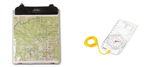
It is important to be prepared for the Edale Skyline Challenge. You need the OS OL1 – Peak District map to navigate the Edale Skyline route. You will carry all clothing, food, water and equipment in your backpack throughout the challenge. It is important to be prepared for the hike and be ready for changes in the weather.
You can view a full equipment list that covers everything required to complete the Edale Skyline Challenge.
Route
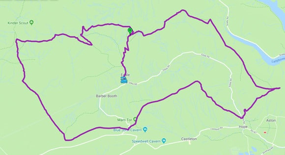
View route in Google Maps
Guided Walks
If the thought of navigating with a map and compass is daunting, you can have a guide from Lost Earth Adventures direct the way for you.
See more information of guided walks of the Edale Skyline Challenge.
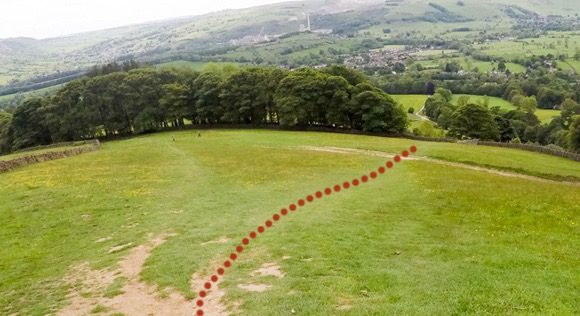
Edale to Ringing Roger
Ringing Roger is the start of your Edale Skyline Challenge. Don’t start timing your challenge until you reach Ringing Roger. It takes about 40 minutes to reach Ringing Roger from The Nags Head.
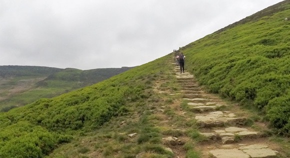
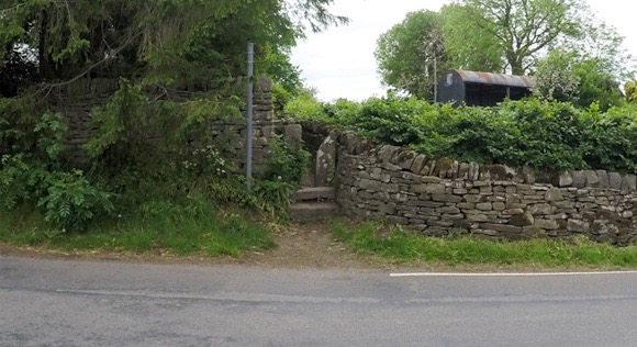
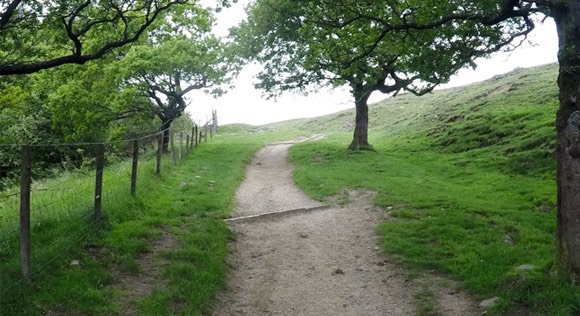
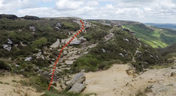
Starting from The Nags Head in Edale, follow the road at the side of the pub. After a couple of minutes you will reach a signpost for Grindsbrook and a path leading through the bushes.
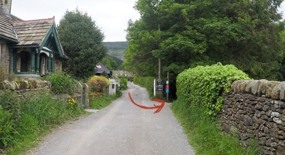
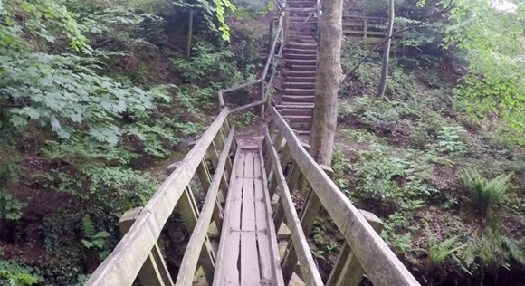
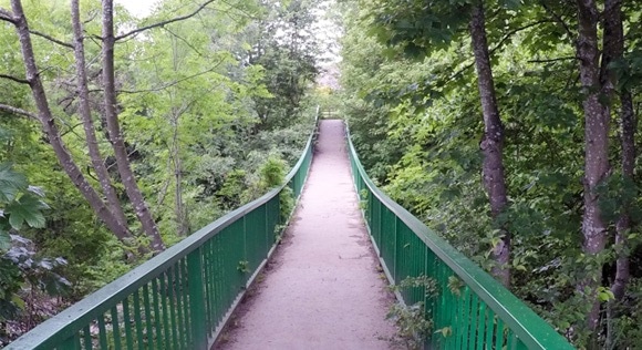
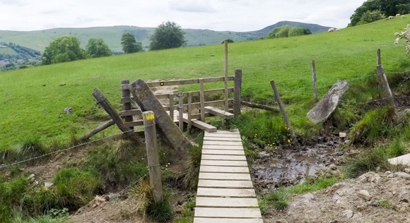
Follow the path down the steps, over the wooden bridge and up the stairs.
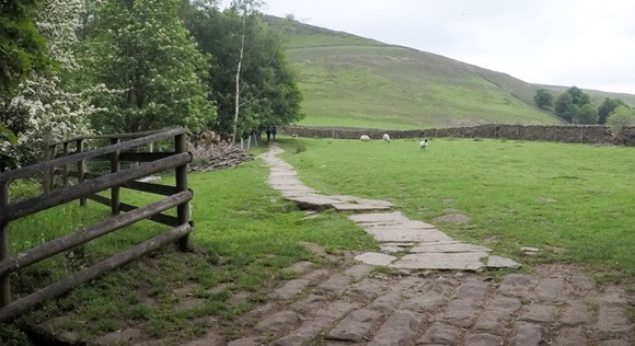
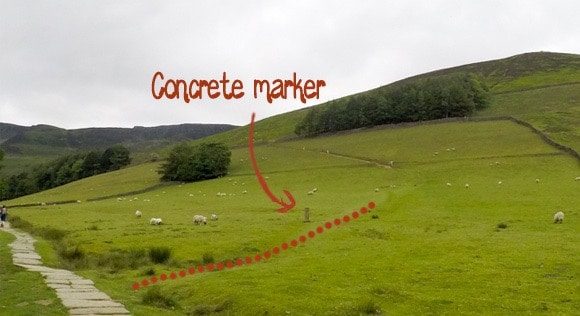
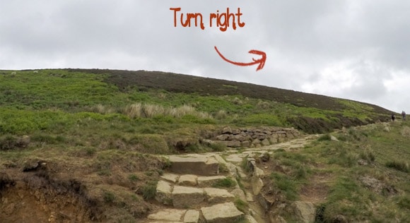
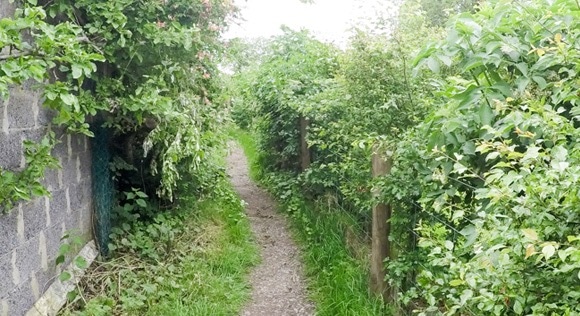
Follow the paved footpath. The next turn isn’t obvious and leads away from the paved footpath onto a grassed route. There is a concrete marker to highlight the right turn.
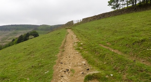
This section may feel tough on the legs. It is the first incline and continues for quite some time. Go through the gate and keep following the path.
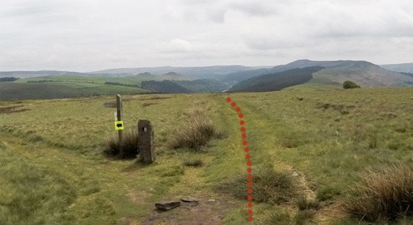
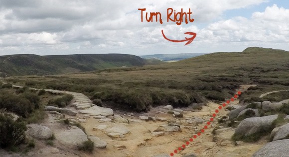
The route joins a path not present on on the OS Map. Turn right.
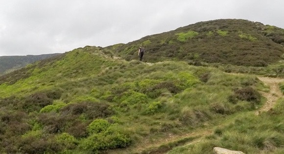
The route curves to the left leading to another incline. From here, the path is a straight line to Ringing Roger and is easy to follow.
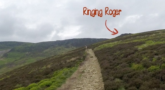
Take the path leading up Ringing Roger. Ringing Roger is 550 metres high and is a comfortable scramble with great views and a collection of large rocks at the summit.
If you are timing your Edale Skyline Challenge, start recording your time at the top of Ringing Roger. You will finish your challenge here.
Ringing Roger to Win Hill
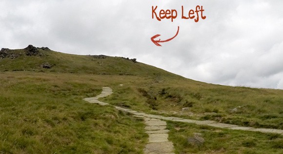
At the top of Ringing Roger head in the same direction that you scrambled/climbed. The path splits in two directions, keep heading right. Some sections of the paths aren’t very clear, just keep to the right-hand side, near the edge of the ridge.
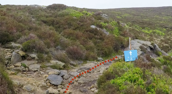
Don’t rely on the blue signpost being present. Salomon were hosting their trial running festival.
Keep right at the next split in the path.
Keep following the path. There are some great views of Hope Valley along the ridge. Keep left at the next split in the path.
Cross the ford and keep following the path to Crookstone Out Moor.
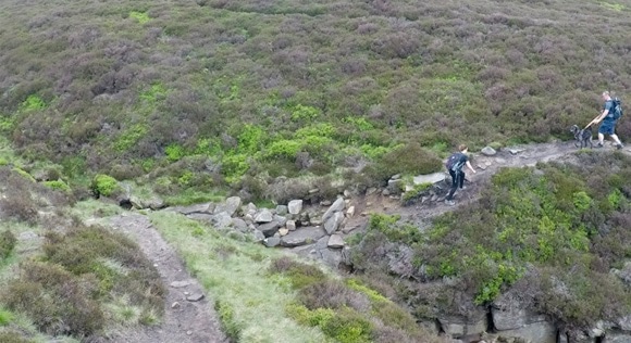
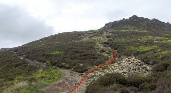
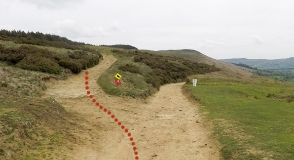
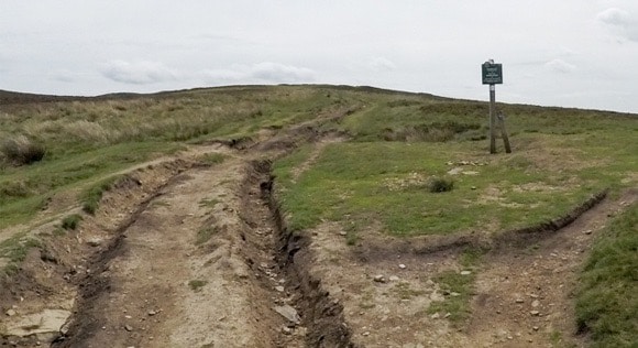
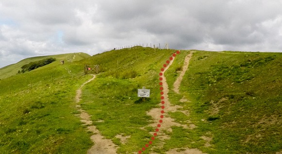
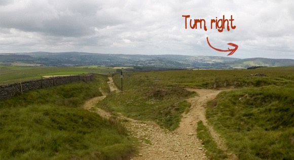
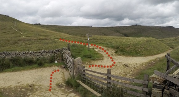
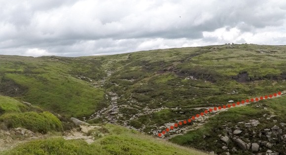
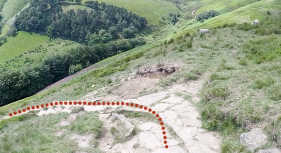
There’s a small decline with large steps that can be slippery when wet. The path is clear to follow. Keep right at the next split in the path. Don’t rely on the red sign in the photograph – it won’t be there during your walk.
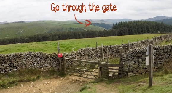
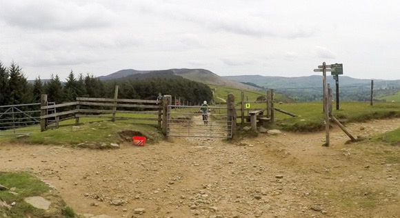
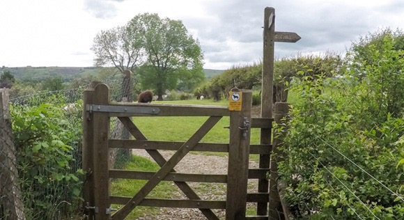
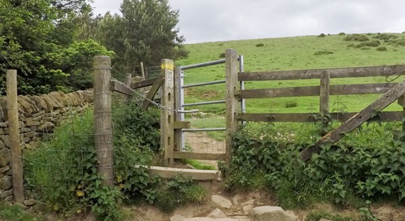
Go through the next gate and keep following the path leading through the field.
At the next signpost, keep right.
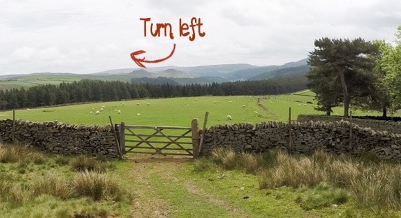
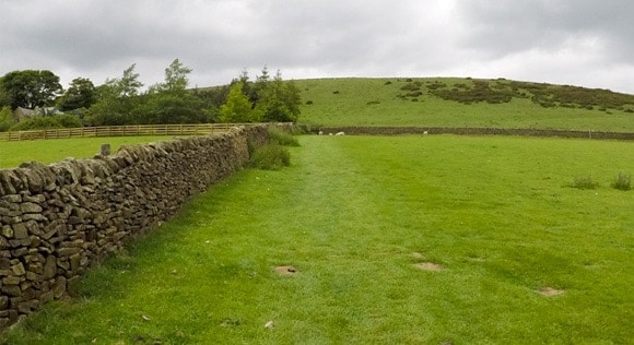
At the sheepfold/Crookstone Barn gate, turn left and follow the wall to the rocky pathway and gate. Go through the gate and follow the stoned path.
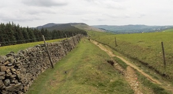
Keeping going straight up at the gate – following the signpost for “Public Bridleway Hope”. This area is popular with hikers and mountain bikers.
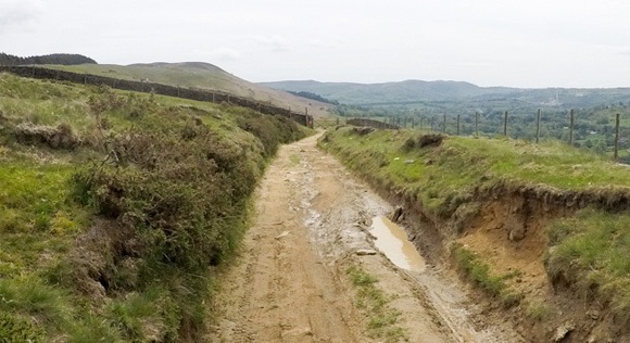
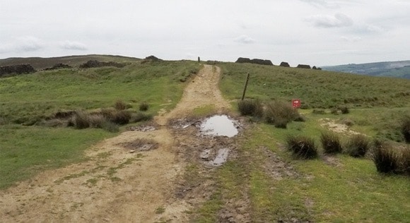
The straight and rocky path is easy to follow but can be waterlogged/muddy after rainfall.
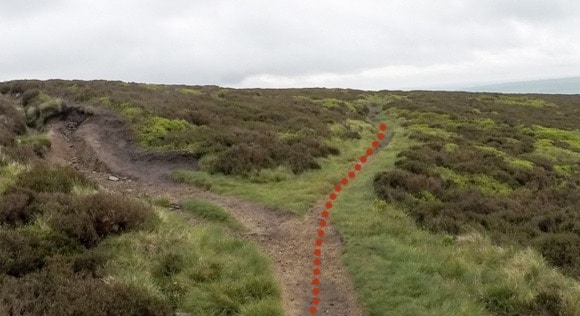
Turn left away from the main path at the next split.
Keep going straight at the next 4-way section, following the main path. The route is marked on the wooden post with a blue arrow.
Keep left at the next signpost. Follow the sign for “Permitted footpath to Win Hill Bridleway”.
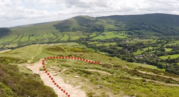
On a clear day you can see Ladybower Reservoir on the route. Win Hill can be seen in the distance.
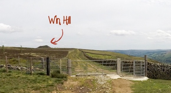
Go through the gate and keep following the path leading up Win Hill. There are some great views of Ladybower Reservoir from the top of Win Hill. Once you have touched the trig, come back on yourself and return down Win Hill using the same route.
Win Hill to Lose Hill
Head left through the first gate and follow the gentle decline.
At the metal gate veer slightly right towards the next gate.
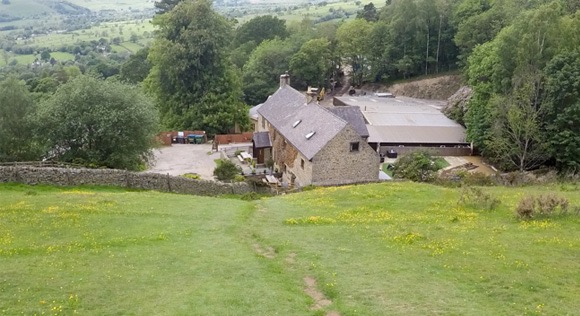
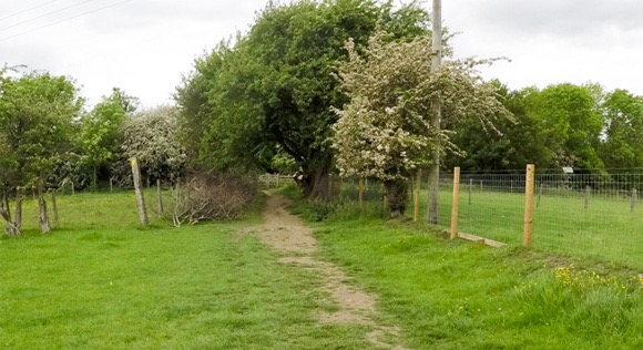
Head towards the buildings, identified as Twitchill Farm on the map. Go through the gate and follow the path leading to the left.
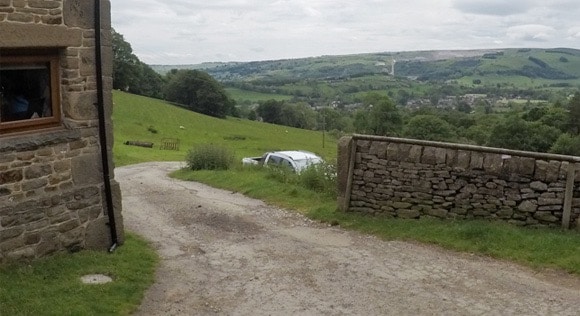
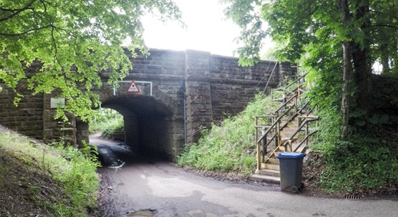
There is a break from inclines/declines with a smooth, concreted path. Keep following the path, go under tunnel and cross the small bridge. The path leads to Edale Road.
Cross Edale Road and squeeze through the narrow stile. Following the sign for “public footpath”
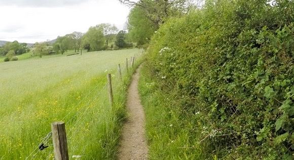
This section isn’t as well followed as other areas in Edale and may be slightly overgrown. Fight your way through the greenery until you reach a gate with a signpost for Lose Hill.
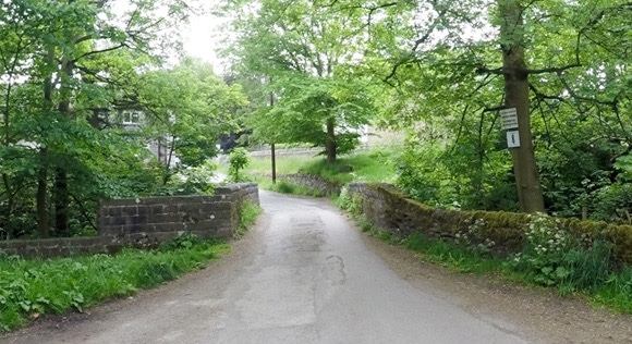
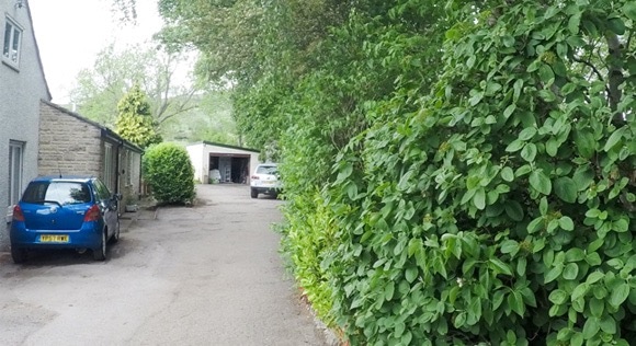
Keep following the path and cross the green bridge. Walk past the house and garage – it feels like you are walking into someones back garden, but it is a public footpath.
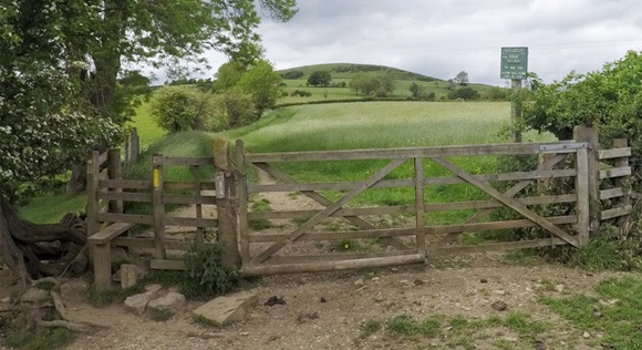
The route quickly returns to grass and rocks. Head through the gates. You will see a signpost for Mam Tor and Lose Hill. The steep incline starts here.
Turn right after crossing the small wooden path and crossing the stile.
Go through the metal gate. Turn left through the wooden gate leading to the gravelled path.

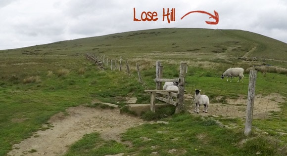
Keep following the uphill route and cross over the stile. The route is easy to follow with Lose Hill in the background. It is quite steep at this section and can be tiring.
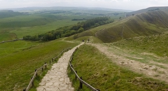
Lose Hill to Mam Tor
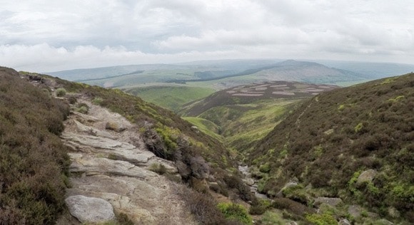
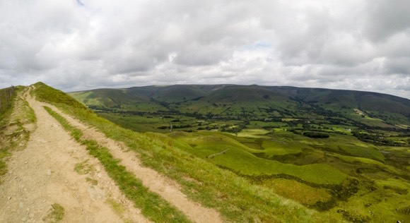
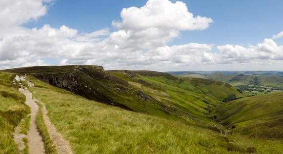
The path between between Lose Hill and Mam Tor is one of the best sections of the Edale Skyline Challenge. The skyline route is clear to follow with amazing views.
Keep following the route to Hollins Cross. Hollins Cross is the lowest point between Lose Hill and Mam Tor and was named after an actual cross that disappeared in 1905. Today, it is identified with a pillar memorial to Tom Hyett, a member of the Long Eaton and District Rambling Group.
Keep going straight after Hollins Cross.
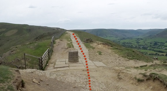
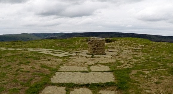
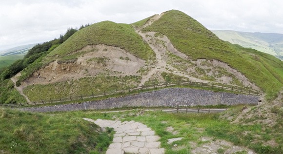
Mam Tor is the final trig of this section.
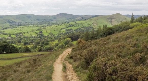
Mam Tor to Brown Knoll
Follow the descending path after Mam Tor’s trig.
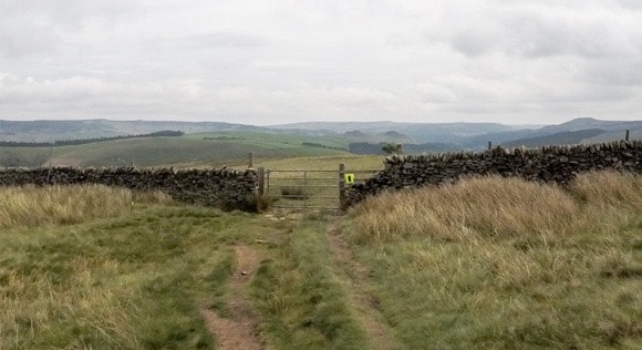
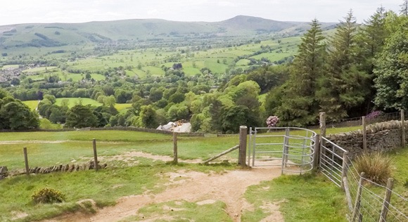
As the main road comes into view, the path leads to the left. Follow the paved path and go through the gate leading onto the road.
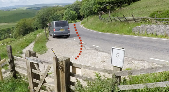
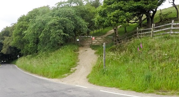
Follow the road for a short while and go through the gate on the other side of the road. The section here is quite steep.
At the split in the path, keep right and follow the signpost for “Footpath Walkers”.
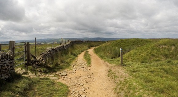
The route is easy to follow along the Edale Skyline ridge. There are a few gates and stiles along the way.
Keep going straight at the signpost and gate. There are blue arrows labelling the Public Bridleway.
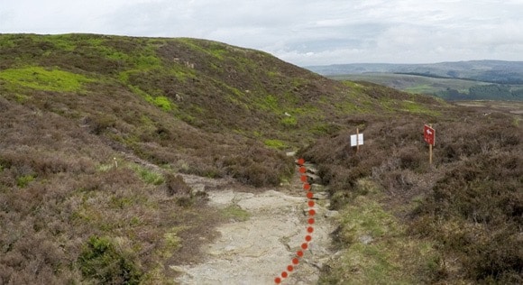
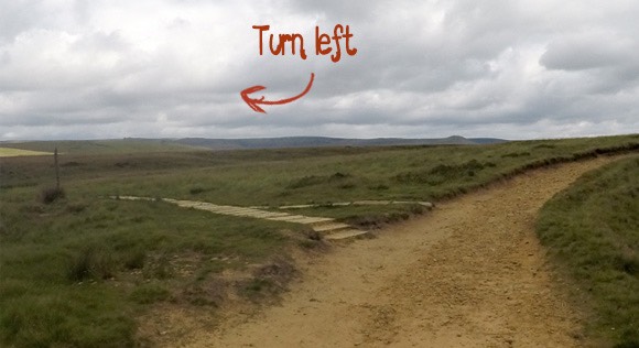
Turn right at the next spilt in the path. The route is marked by the signpost “Edale via Barber Booth”.
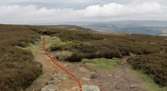
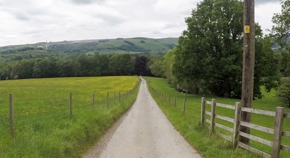
The next important turn isn’t too far away. The path leads from a chalky pathway to a paved route. The paved route is a long path leading directly to Brown Knoll.
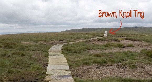
Brown Knoll To Kinder Low
There is an important right turn not too far after Brown Knoll.
The next turn is marked with a gate and signpost. Follow the signpost for “Pennine Way”.
Follow the path veering to the left at the next section.
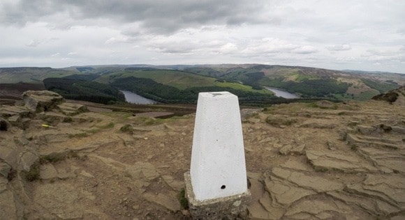
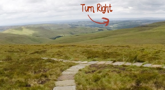
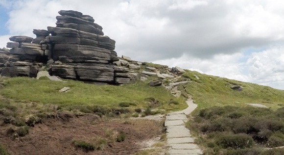
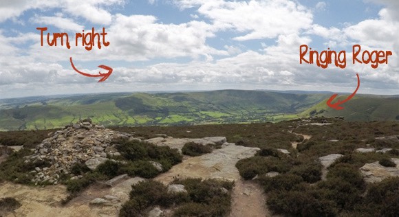
This guide and route of Edale Skyline ventures to Kinder Low. Not all routes of Edale Skyline go to Kinder Low. It is a small detour to visit the highest trig of the Peak District and worthy of being a part of the Edale Skyline Challenge. If you don’t want to visit Kinder Low, head right towards Noe Stool. If you wish to visit Kinder Low, head left, towards Edale Rocks. Both routes meet at Noe Stool and the detour to Kinder Low takes about 15 minutes.
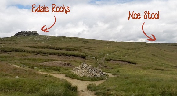
Follow the route to Edale Rocks and keep to the path on the right-hand side of Edale Rocks. The Kinder Low trig comes into view a few minutes after passing Edale Rocks.

Kinder Low to Grindslow Knoll
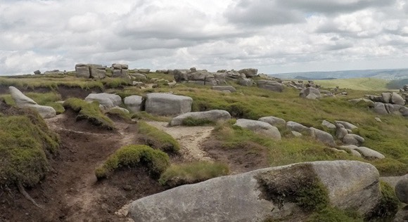
After touching Kinder Low trig, head to the right, down the dried up river bed. Use the large rocks in the background as a marker to lead you to Noe Stool.
Noe Stool is a large distinct rock.
From Noe Stool the clear path leads to the Wool Packs, a large section of scattered rocks. The path isn’t always obvious through the Wool Packs, but keep heading in the same direction (East).
There are a number of paths to follow at the fords of Crowden Clough. Follow the path leading straight over.
The next turn follows the less obvious path. You come away from the paved route to the rocky path leading to Grindslow Knoll.
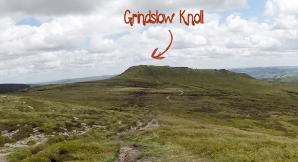
There isn’t a trig at the top of Grindslow Knoll but there are great views from the top.
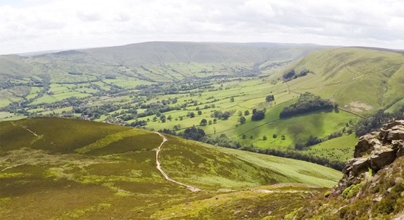
Grindslow Knoll to Ringing Roger
From the top of Grindslow Knoll, look back the way you came and take the path leading downing to the right.
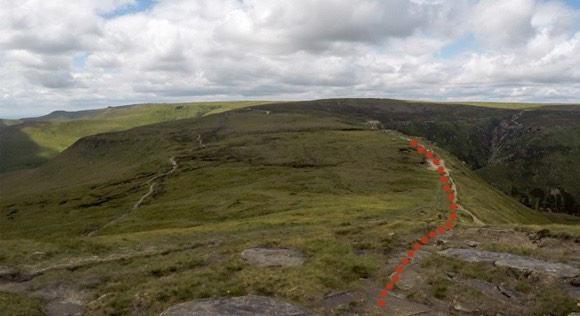
You will reach a cross section with the descent down Grindsbrook Clough to your right. Go straight ahead.
The path is clear to follow with no inclines or declines. This is the final section of the Edale Skyline route, taking you along Upper Tor and Nether Tor and leading to Ringing Roger.
Turn right at the pile of rocks. You can see the rocks atop of Ringing Roger.
Once you return to Ringing Roger that is the end of your Edale Skyline Challenge and you can log your official time.
Returning to Edale
You return to Edale the same way you came to Ringing Roger so the route will be familiar to you.
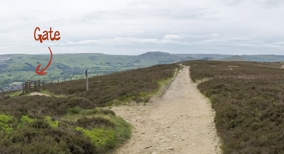
You can see the path from top of Ringing Roger. Descend Ringing Roger carefully to reach the path.
Turn right at the section on the map titled The Nab.
Keep left, following the obvious route, where the grass and paved routes meet.
After you have completed the descent, turn left onto the paved pathway leading to the wooden bridge and steps. Turn left onto the main road and follow it back to the Nags Head.
Frequently Asked Questions
What equipment do you need to complete the Edale Skyline challenge?
You need a map and compass, warm clothes (it may be cold along the Edale skyline, even in summer) and a backpack to keep it all in. Visit the hiking equipment page to ensure you have all of the required equipment.
Can you complete the Edale Skyline Challenge all year round?
The Edale Skyline can be completed on any day of the year. It can be cold, boggy and windy due to the open nature of the countryside, especially outside of summer. The amount of daylight may be crucial depending on your estimated finish time. If you are hoping to complete the challenge in sunshine with long hours of daylight, it is recommended to plan your trip between April-September.
How long does it take to complete the Edale Skyline Challenge?
The challenge is to complete the circular route in less than 10 hours.
What terrain is the Edale Skyline?
The route is a combination of grass (which can become boggy after rainfall), gravel, steps, mud, tarmac and rocks.
Can you complete the Edale Skyline in trainers?
It is not recommended to complete the challenge in trainers. Due to the diverse terrain, lack of ankle protection, inclines, declines and unpredictable weather, trainers are not suitable footwear for the challenge.
Are dogs allowed on the route?
Dogs are allowed on the Edale Skyline route. During the breeding season of spring and early summer, new-born lambs and ground-nesting birds are particularly vulnerable to harm from dogs. Always use a short lead if you can’t rely on your dog’s obedience.
How much food/water will I need to take?
A backpack is required to carry enough food and drink for the full day’s hike. It is recommended to take at least 3 litres of water. The weather and temperature needs to be taken into consideration and adjust the required amount of water as necessary. A hot day will require more fluids. Take as much food as you can comfortably carry and high-energy foods are desirable due to their size.
How much training is required?
Some people will be able to complete the Edale Skyline without training; others may require a couple of months. The level of training required is unique to each individual depending on current fitness levels and age. It is recommended to practice at least one long walk (15+ miles) with inclines and declines to assess the difficulty. You could complete some of the Edale Skyline route on the Kinderscout via Jacobs ladder walk, (8.5 miles; 14 km). You could complete one or two of the Yorkshire Three Peaks or tackle one of the National Three Peaks. You could climb England’s third highest peaks: Helvellyn (8 miles; 13 km).
Is it free to complete?
The Edale Skyline is free to complete. You can donate to the Peak District, who maintain the pathways.
Where can you start the challenge?
You can start the challenge anywhere on the Edale Skyline route. This guide starts in Edale due to the train station and large car park.
Are there any toilets on the route?
There are public toilets in the Edale Car Park at the start of the walk and public toilets in Hope Car Park on Castleton Road, which is a short walk from the Edale Skyline route.
Do you need any specialist climbing equipment?
No. The Edale Skyline Challenge is completed by walking.
Do you need a guide to complete the challenge?
No. You can arrange your own walk with a map and compass. If you wish to attend a guided walk, contact Lost Earth Adventures.
Can you drop out if you cannot complete the challenge?
You can drop out at Hope – there is a train service from Hope to Edale. You can also drop out at Mam Tor and walk back to Edale.