
Summary
Distance: 8.5 miles (14 km)
Difficulty: Medium
Total Ascent: 653 m
Estimated Time: 4-5 hours
Map: Ordnance Survey Explorer OL1 The Peak District
Route: View in Google Maps
GPX File: Download GPX file (desktop only) – What is a GPX file?
Kinder Scout is the highest point in the Peak District. It was also the centre of the The Kinder Scout Mass Trespass in 1932. Five people were arrested during the civil disobedience in a fight for the “right to roam”. Over 400 people trespassed though the Peak District in rebellion. The general public haven’t always had access to the countryside, access was restricted by wealthy landowners, and the protest changed history for ramblers. It paved the way for National Parks and long distance walking routes, such as The Pennine Way.
The circular walk of Jacob’s Ladder and Kinder Scout has a lot of variety. There are challenging inclines, areas of scrambling, the option of climbing boulders, stream crossings and amazing views along the way.
Is Kinder Scout Low the same as Kinder Scout?
No. The official summit of Kinder Scout doesn’t have a trig or a designated path. The plateau of Kinder Scout is often waterlogged and boggy. A seasoned hiker may wish to navigate to the official, but uneventful, summit of Kinder Scout, but Kinder Scout Low is much easier to locate and identifies the highest point with a trig.

This guide leads to Kinder Scout Low, but will refer to it as Kinder Scout.
Kinder Scout Low (633 metres) is only 3 metres lower than the highest point of Kinder Scout (636 metres).

Kinder Scout Low trig
Route
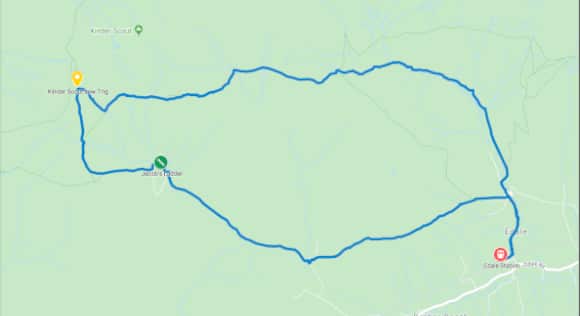
View Route in Google Maps
The Kinder Scout and Jacob’s Ladder route starts in Edale. Edale is accessible by car or by public transport.
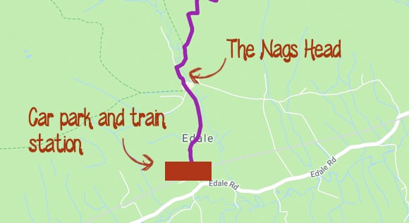
Edale train station and car park are close to each other. They are both a short walk to The Nags Head, where the walk to Jacob’s Ladder begins.
The Edale Village Hall Car Park is a pay-and-display car park. The full address is Edale Village Hall Car Park, Edale, Hope Valley, S33 7ZQ.
A full day’s parking is £6.30. The car park is cash only. Paying by card or phone is not an option at the moment. The car park does get busy, but has space for 140 cars. An overflow car park is available on peak days. The car park has limited disabled and coach parking.
Map
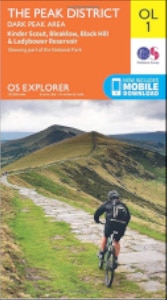
The map required for Kinder Scout and Jacob’s Ladder is the Ordnance Survey Explorer OL1 The Peak District.
The key points can be located on the OS map using 6-figure grid references:
- Edale (123859)
- Jacob’s ladder (087862)
- Kinder Scout (078872)
- Grindsbrook Clough (105873)
If you are unsure how to use 6-figure grid references, the 2-minute video from the Ordnance Survey is a very easy-to-follow guide. They also have written instructions on their website.
Starting the Kinder Scout Walk
From Edale Train Station or Village Hall Car Park, head north on the main road. Keep following the road, passing The Rambler Inn and the Edale Church. There isn’t a designated path for hikers but the road is often quiet.


The official start of The Pennine Way is left of the The Old Nags Head pub. The Pennine Way spans 268 miles and ends in Kirk Yetholm. The Kinder Scout route follows a small section of The Pennine Way.


The start of the Pennine Way is well signposted and easy to follow. The first section leads through an overgrown area, eventually leading to the first of many gates.
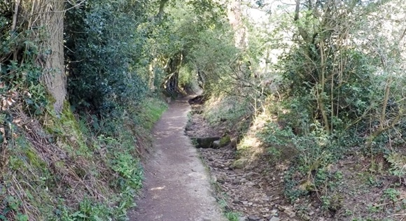


Keep following the path until you reach a split. Follow the clear path leading off to the left, heading towards Upper Booth.

You are greeted with another gate upon your arrival at Upper Booth. Go through the gate and take a left. Follow the road through Upper Booth until you reach a signpost for Jacob’s Ladder.


Jacob’s Ladder consists of numerous steps. It is over quickly but the steps can be tiring. The steps are wide enough to accommodate resting walkers if you require any stops.

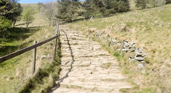

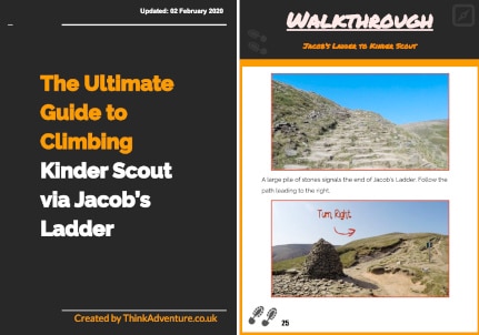
A large pile of stones signals the end of Jacob’s Ladder. Follow the path leading to the right.

Follow the path until you reach a paved section leading to the right. The path goes to Edale Rocks. Depending on the weather, you may be able to see Edale Rocks in the background from here.

The next turning point is clear thanks to the pile of rocks. Take the left trail towards Edale Rocks. The other path leads to Noe Stool, which you can see on a clear day.

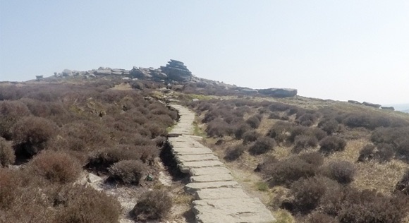
Edale Rocks provides shelter from the elements and is a good spot for a rest or a scramble.

Keep heading north and Kinder Scout trig will appear shortly.

Depending on recent weather, you can walk down the river bed to the right of Kinder Scout trig. The river track is a shortcut to the path leading to Noe Stool. If the river track is too boggy, head back to Edale Rocks and to the pile of stones and take the path leading to Noe Stool.

The riverbed and path from Edale Rocks join for the final stretch towards Noe Stool. On a clear day you will see Noe Stool and navigation will be simple. It isn’t a concreted pathway, but the ground is worn from other walkers. Noe Stool is hard to miss. It is a large lone rock.

Riverbed joining path

Worn path leading to Noe Stool

Noe Stool
The path for the next mile or so leads through a number of rocks and boulders. The path comes and goes but it easy to navigate amongst the rocks – keep heading in the same direction. This area is identified on the OS Map as Woolpacks.

The path reaches an area with a few options to choose from. Keep following the path east.


Keep left at the next two splits in the path.


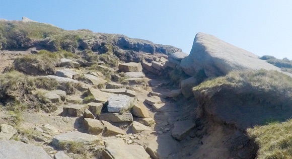
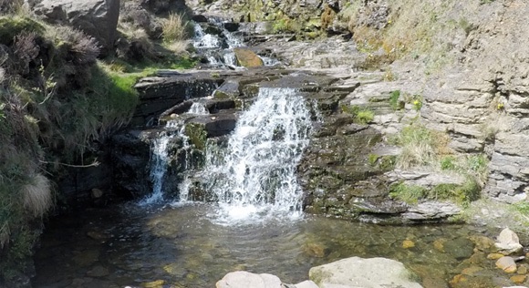
This is the start of the Grindsbrook Clough descent. The area can be wet and slippery so take your time coming down the rocks and be careful when scrambling down. This area is a fun scramble with its own little water features.


As you reach the bottom you need to cross Grinds Brook. The stream will be on your right-hand side for the remainder of the walk back to Edale.


It’s a friendly route from here: flat and clear paths lead the way.

Cross over the little wooden bridge and head through the gate.


Keep following the path to The Old Nags Head pub.

Congratulations. That’s the end of Jacob’s Ladder and Kinder Scout.
Frequently Asked Questions
What equipment do you need to complete the Kinder Scout via Jacob’s Ladder walk?
You need a map and compass, warm clothes (it may be cold in the Peak District, even in summer) and a backpack to keep it all in. Visit the hiking equipment page to ensure you have all of the required equipment.
Can you complete the Kinder Scout via Jacob’s Ladder walk all year round?
Kinder Scout and Jacob’s ladder can be visited any day of the year. It can be cold, boggy and windy due to the open nature of the countryside, especially outside of summer. If you wish to complete the challenge in sunshine with long hours of daylight, it is recommended to plan your trip between April-September.
How long does it take to complete the Kinder Scout and Jacob’s Ladder circular route?
It takes 4-5 hours depending on your fitness level and walking speed.
What terrain is the Kinder Scout and Jacob’s Ladder walk?
The route is a combination of grass (which can become boggy after rainfall), gravel, steps, mud, tarmac and rocks.
Can you complete the Kinder Scout and Jacob’s Ladder walk in trainers?
It is not recommended to complete the challenge in trainers. Due to the diverse terrain, lack of ankle protection, inclines, declines and unpredictable weather, trainers are not suitable footwear for the challenge.
Are dogs allowed on the route?
Dogs are allowed in the Peak District. During the breeding season of spring and early summer, new-born lambs and ground-nesting birds are particularly vulnerable to harm from dogs. Always use a short lead if you can’t rely on your dog’s obedience.
How much water will I need to take?
A backpack is required to carry enough food and drink for the day’s hike. It is recommended to take at least 2-3 litres of water. The weather and temperature needs to be taken into consideration and adjust the required amount of water as necessary. A hot day will require more fluids.
How much training is required?
Some people can complete the Kinder Scout via Jacob’s Ladder walk without training; others may require a couple of months. The level of training required is unique to each individual depending on fitness level and age. It is recommended to practice at least one long walk (8+ miles) with inclines and declines to assess the difficulty. The Kinder Scout walk is a great introductory walk to long hikes. Jacob’s Ladder is tiring, but it doesn’t last for very long.
Is it free to complete?
The Kinder Scout/Jacob’s Ladder walk is free to complete. You can donate to the Peak District, who maintain the pathways.
Where can you start the Kinder Scout via Jacob’s Ladder walk?
You can start the challenge anywhere on the route. This guide starts in Edale due to the train station and large car park. It also leads up Jacob’s Ladder, rather than down, which makes for a better experience.
Are there any toilets on the route?
There are public toilets in the Edale Car Park at the start of the walk. There are no toilets on the route.
Do you need any specialist climbing equipment?
No. Kinder Scout and Jacob’s ladder are completed by walking.
Do you need a guide to complete the challenge?
No. You can arrange your own walk with a map and compass. If you wish to attend a guided walk, contact Lost Earth Adventures.